|

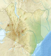
The Arawale National Reserve is a designated conservation area managed by the Garissa County in assistance with the Kenya Wildlife Service. It lies in North Eastern Province of Kenya, 77 km south of the town of Garissa. The reserve covers an area of 53,324 hectares (533 km; 206 sq mi).[1] To the west, it is bordered by the Tana River and, to the east, by the Garissa-Lamu road. In 1974, the reserve was gazetted as the only in-situ conservation site for the critically endangered Hirola population endemic to north-eastern Kenya and south-west Somalia.


