|

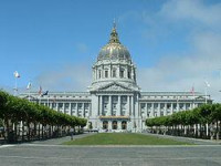
San Francisco City Hall, re-opened in 1915, in its open space area in the city's Civic Center, is a Beaux-Arts monument to the City Beautiful movement that epitomized the high-minded American Renaissance of the 1880s to 1917. The structure's dome is the fifth largest in the world.[6] The present building replaced an earlier City Hall that was completely destroyed during the 1906 earthquake, which was 2 blocks from the present one. It was bounded by Larkin Street, McAllister Street, and City Hall Avenue (a street, now built over, which ran from the corner of Grove and Larkin to the corner of McAllister and Leavenworth), largely where the current Public Library and U.N. Plaza stand today.


