|

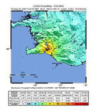
The 2008 Iceland earthquake was a doublet earthquake that struck on May 29, 2008 at 15:46 UTC in southwestern Iceland. The recorded magnitudes of the two main quakes were 5.9 Mw and 5.8 Mw, respectively, giving a composite magnitude of 6.1Mw.[1] There were no human fatalities, but 30 injuries were reported and a number of sheep were killed.[2] The epicenter of the earthquake was between the towns of Hveragerði and Selfoss, about 45 kilometers (28 mi) east-southeast of the capital, Reykjavík. It was the strongest earthquake to hit Iceland since the summer of 2000.[3]


