Wikiplacemarks.com  


Find us on Google+

Indian Boundary Park

View on map:42.009440°N 87.693330°W

Description


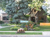
Indian Boundary Park

Indian Boundary Park is a 13-acre (5.3 ha) urban park in the West Ridge neighborhood of Chicago that opened in 1922. It is named after a boundary line that was determined in the 1816 Treaty of St. Louis between the Odawa, Ojibwe, and Potawatomi tribes and the United States government. The line ran through the present park.[3]

References

All text is available under the terms of the Creative Commons Attribution-ShareAlike License
Average user rating: 3.0

Click on a star to rate
 

애플리케이션으로 만들고 싶은 양식이 있으십니까?

좋은 아이디어 있으시면 저희에게 알려주십시오.

Contact us...