Wikiplacemarks.com  


Find us on Google+

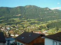
Goldau Landslide

View on map:47.048060°N 8.549720°E

Description


Goldau

On September 2, 1806 heavy rains triggered a landslide from the Rossberg which destroyed Goldau and the adjacent villages of Busingen, Röthen and Lauerz. The landslide comprised 40,000,000 cubic metres (52,000,000 cu yd) of material, with a mass of 120,000,000 tonnes (118,000,000 long tons; 132,000,000 short tons).[2][3]

References

All text is available under the terms of the Creative Commons Attribution-ShareAlike License
Average user rating: Not rated

Click on a star to rate
 

애플리케이션으로 만들고 싶은 양식이 있으십니까?

좋은 아이디어 있으시면 저희에게 알려주십시오.

Contact us...