|

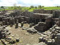
Vindolanda was a Roman auxiliary fort (castrum) just south of Hadrian's Wall in northern England. Located near the modern village of Bardon Mill, it guarded the Stanegate, the Roman road from the River Tyne to the Solway Firth. It is noted for the Vindolanda tablets, among the most important finds of military and private correspondence (written on wooden tablets) found anywhere in the Roman Empire.


