|

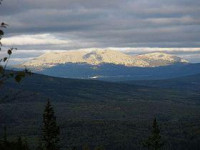
Mount Yamantau (Russian: гора Ямантау) is in the Ural Mountains, Bashkortostan, Russia. The name means bad (evil) mountain in the Bashkir language (Яман тау). It is also known as Mount Yamantaw. It stands at 1,640 metres (5,381 ft) and is the highest mountain in the southern Urals. Along with Kosvinsky Mountain (600 km to the north), it is suspected by the United States of being a large secret nuclear facility and/or bunker.[1] The closed military town of Mezhgorye (Russian: Межгорье) is situated nearby. As late as 2003, Yamantaw was not yet fully operational.[1]


