|

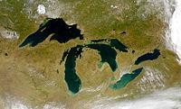
Mackinac Falls is a submerged 100-foot (30 m)-high waterfall formation under the waters of Lake Huron. The formation, which lies approximately 1 mile (1.5 km) east of Arch Rock on Mackinac Island, was the former outflow point for water flowing eastward from postglacial Lake Michigan. The formation was discovered on August 16, 2007.


 Ossza meg velünk az ötleteit!