|

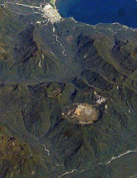
Chaitén is a volcanic caldera 3 kilometres (2 mi) in diameter, 17 kilometres (11 mi) west of the elongated ice-capped Michinmahuida volcano and 10 kilometres (6 mi) northeast of the town of Chaitén, near the Gulf of Corcovado in southern Chile. The most recent eruptive phase of the volcano began on 2 May 2008, and is ongoing. According to the Global Volcanism Program, radiocarbon dating of older tephra from the volcano suggests that its last previous eruption was in 7420 BC ± 75 years.


 Ossza meg velünk az ötleteit!